


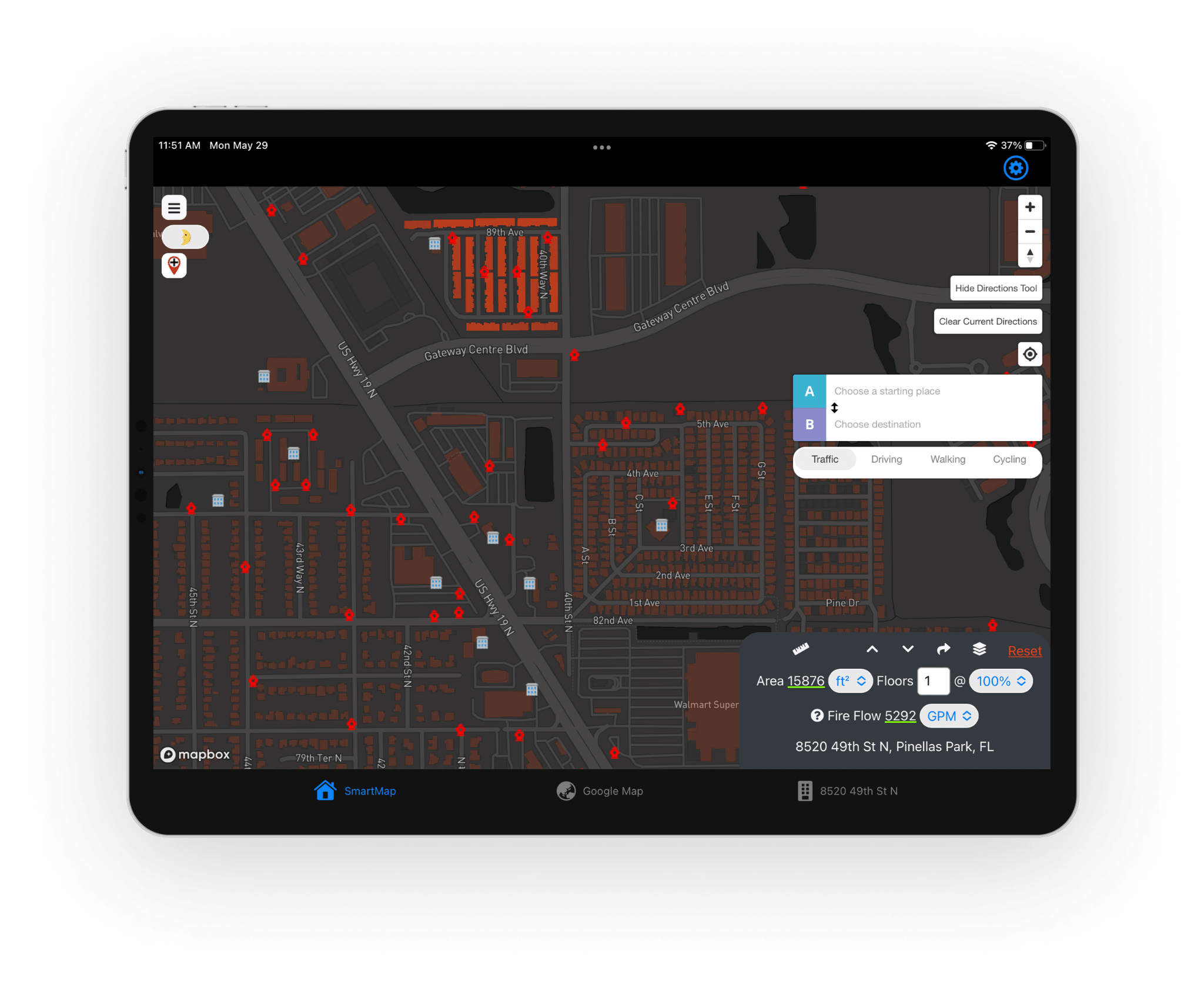
Easy to use interface that provides quick access to critical building data, possible access hazards, water source data, routing, and other valuable information.

Highlights the closest water source to a selected address, and surfaces key information such as required flow rate, the nearest hydrants to meet these flows, and distance between the building and hydrants.

Markup tools allow command strategies to be defined and communicated with responding personnel. Maps can be saved and used later for training and post-incident reviews.
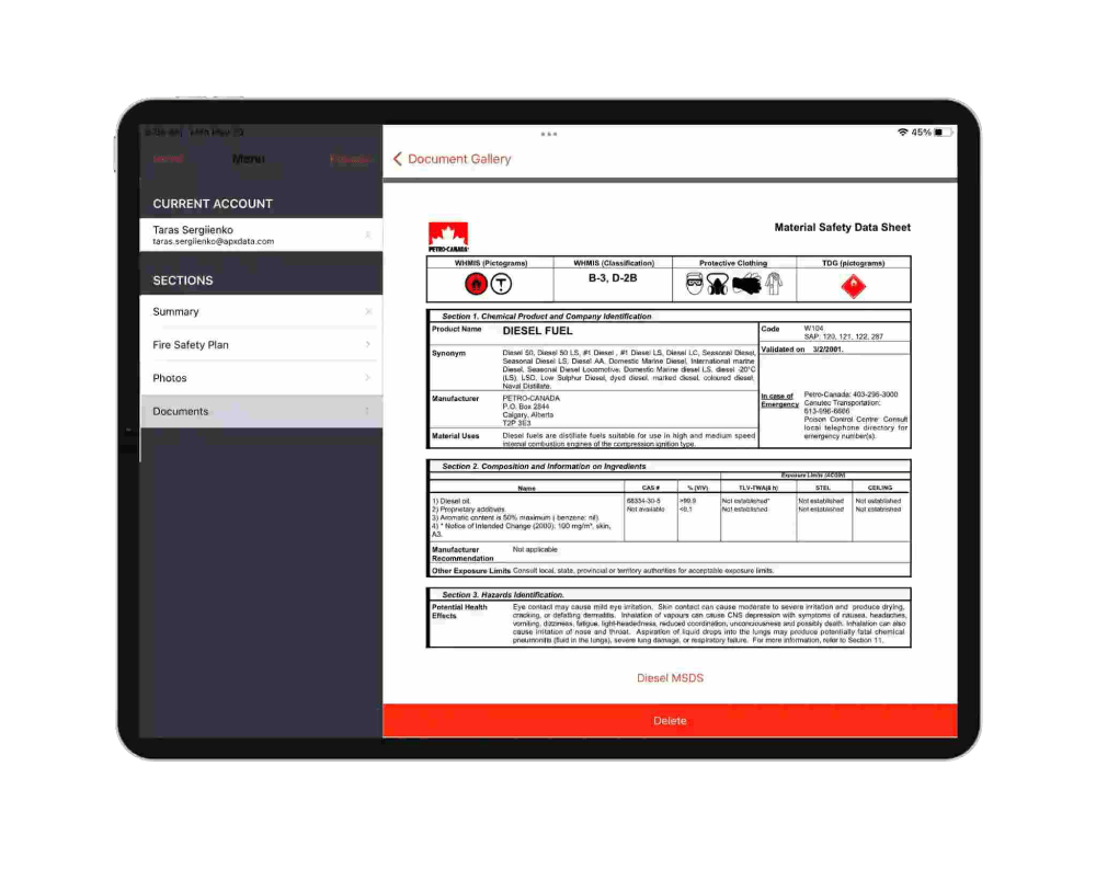
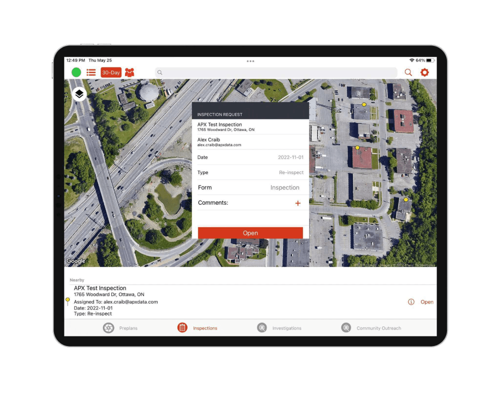
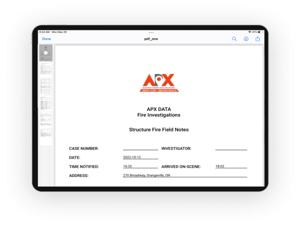
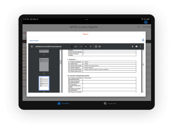
View the most current pre-plan and inspection reports on the property, gaining a quick understanding of the building’s details and possible hazards.

Automatically calculates the building area for a selected address, along with fire flow requirements, based on National Fire Academy (NFA) requirements.
Secured Access removing the need to manage multiple log-ins.


Marco Island Fire-Rescue Department, FL

Nebraska State Fire Marshal

Kearney Volunteer Fire Department, NE

South Sioux City Fire Department, NE

Johns Greek, GA

Chief Chris Armstrong
Hall County, Georgia, United States

Fire Chief Tracey Kujawa
Wausau Fire Department, Wisconsin, United States

Fire Chief Kim Ayotte
Ottawa Fire Service, Ontario, Canada
Every Structure

Dispatch Notifications

Share information

Hydrants information

Pre-plans and inspection reports

Improve Situational Awareness
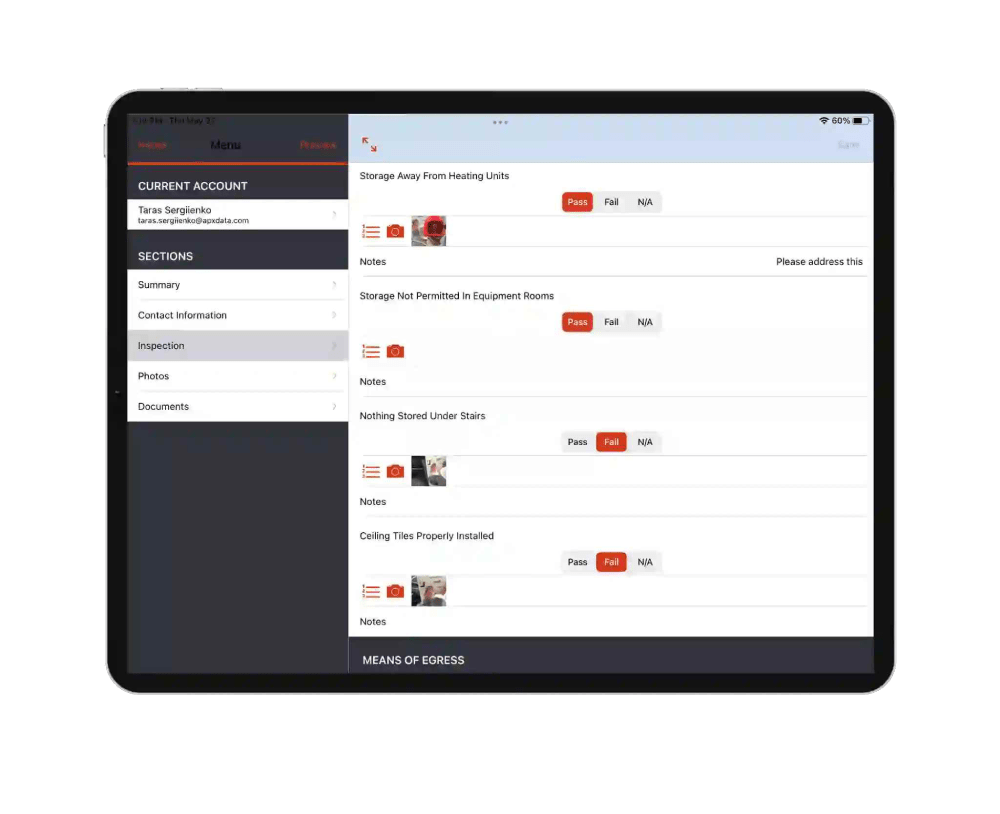
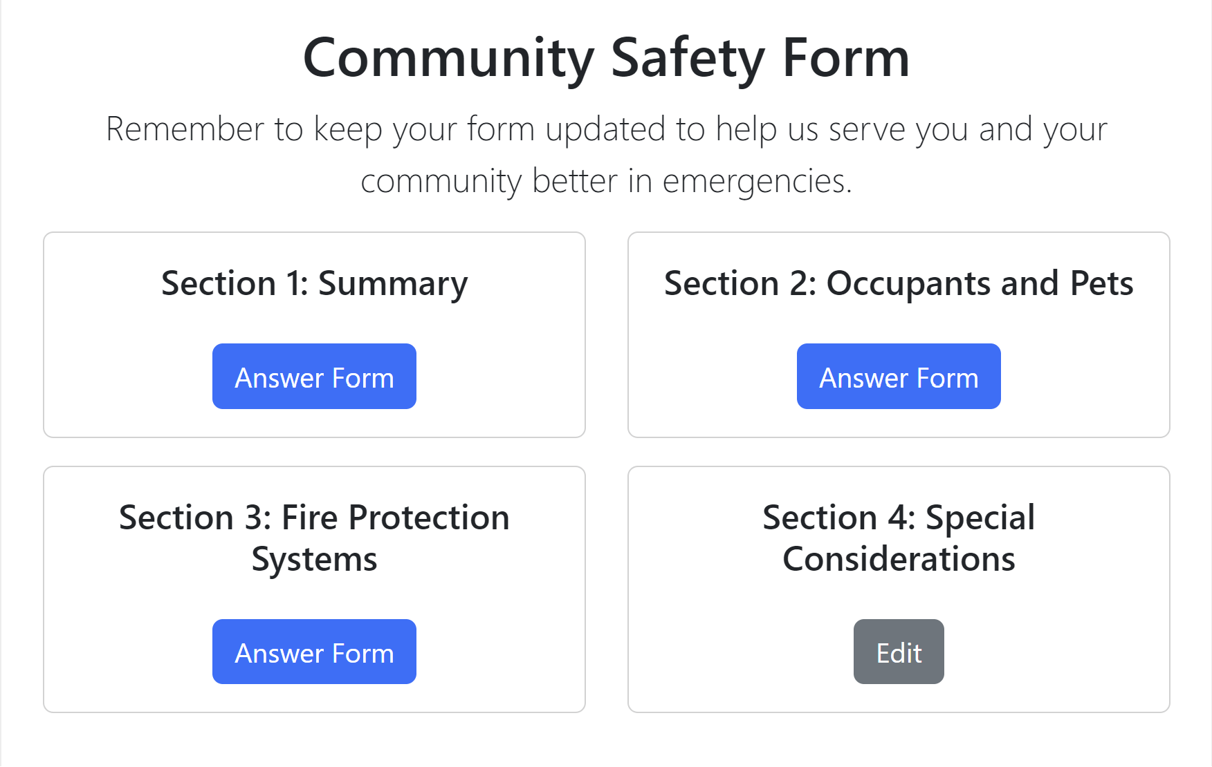
Customizable forms and fields

Image Capture and Annotation
Share with Mutual Aid Departments

NFPA 1620 Compliant

Complete Pre-Plans simultaneously

Manage schedules and track activity

Works offline without internet
Capture photos of violations

Generate permits and invoices easily

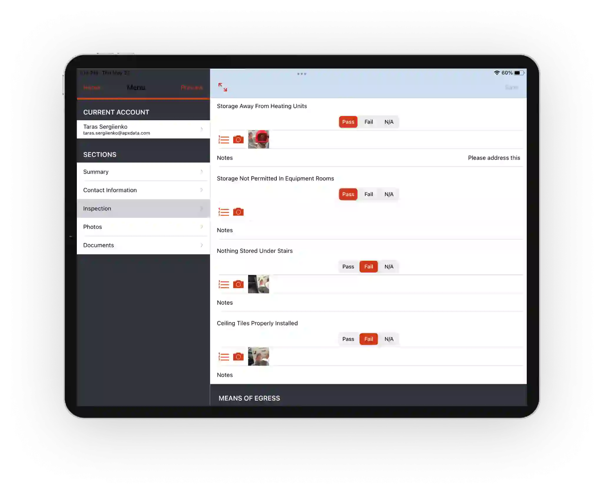
Data collection in the field
Utilize checklists, capture images and dictate observations
Easily share reports with civilian entities

Dashboards and Historical Information
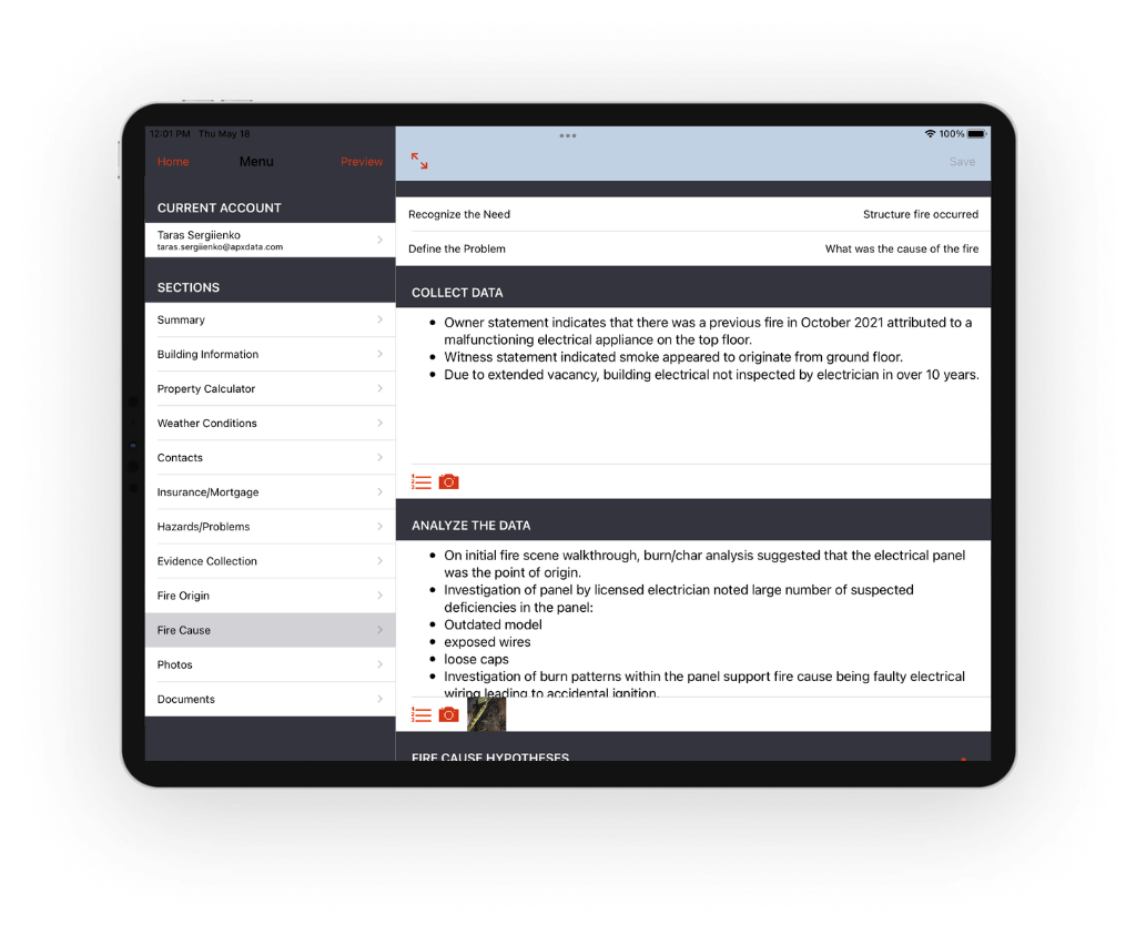
NFPA 921 Compliant


Guided Form Based Input
Field and Form Level Validation

Image Collection and Annotation
Administration and Reporting
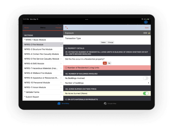
NFIRS 5.0 Compliant

Secure web portal for citizens
Citizen data available during response
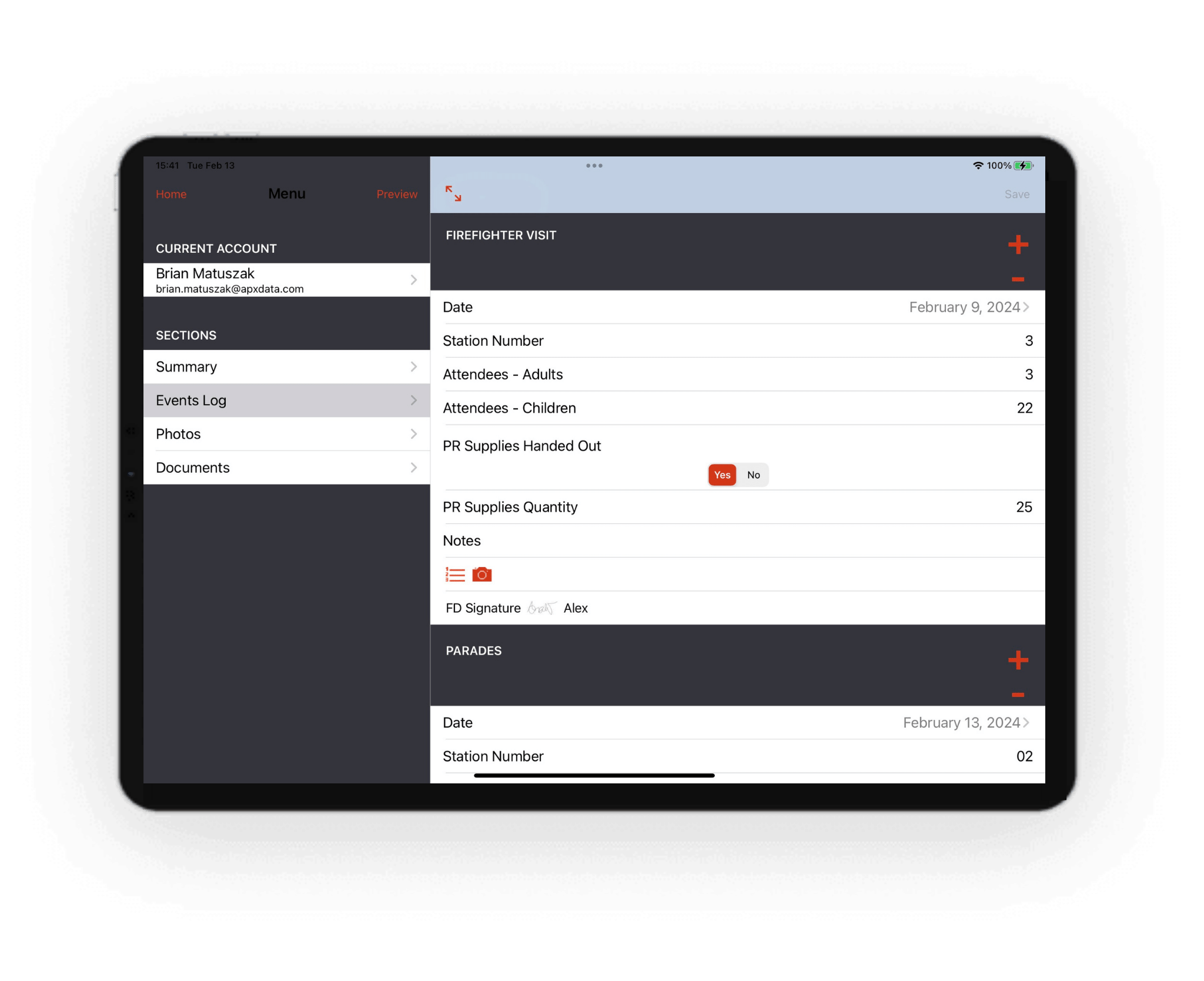
Track fire prevention and community activities
Promotes community involvement
Report on activities for funding

Customized Checklists for Vehicles
Flag issues and Create Alerts
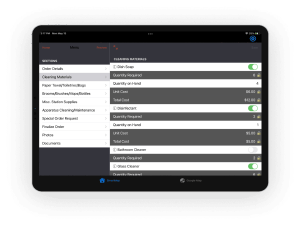
Station Supplies and Inventory

Schedule and Assign Tasks

Compliance Reporting

Mobile Based

Full Customization

World Class Support
